
Trying To Figure Out The Coming Winter In Utah? Good Luck!
Apparently, it is time to start worrying about winter.
Not winter as in “maybe I should find the snow shovel.” I mean winter as in people are already producing forecasts for what December, January and February are going to look like.
And, naturally, we have two different forecasts.
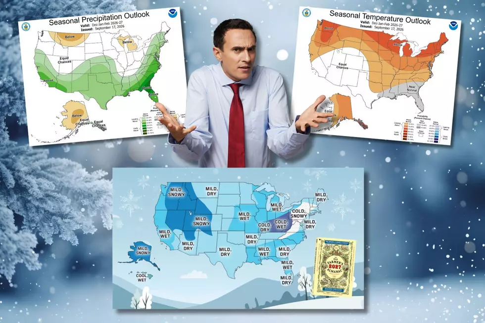
The Old Farmer’s Almanac says the Intermountain region—which includes much of Utah—is in for a warmer and wetter-than-normal winter, with above-normal snowfall. It even identifies late November, late December and early February as particularly snowy periods.

Meanwhile, NOAA’s Climate Prediction Center is looking at the same upcoming winter through a somewhat different lens. Its seasonal outlooks are probability forecasts rather than a declaration that “this is what winter will do.” The current December-through-February outlook incorporates the developing strong El Niño and favors above-normal temperatures across much of the West, while the precipitation picture is more dependent on location.


So are they contradicting each other?
Not really.
And that's where this gets fun.
A warmer-than-normal winter can still be snowier than normal. Those two things are not mutually exclusive. If you get fewer cold days but a handful of well-timed, moisture-loaded storms that arrive cold enough to produce snow, you can wind up with more snow even though the season's average temperature is higher.

In other words, winter doesn't have to choose.
It can be warm.
It can be wet.
And then it can dump three feet of snow on you just to demonstrate that meteorology enjoys irony.

There's another complication for those of us in Southern Utah. The Almanac actually puts the Desert Southwest in a different forecast category, calling for a warmer and drier winter there, with below-normal snowfall in places that normally receive snow.
So now we're down to a question of geography.
Where, precisely, does your particular patch of Southern Utah fit on somebody else's map?
That's a considerably harder question than forecasting the general behavior of the atmosphere over an entire season.

NOAA's forecast is telling us about probabilities and broad-scale patterns. The Almanac is offering a regional interpretation. Neither one is promising that Cedar City will get exactly 14.7 inches of snow, 3.2 inches of rain and six sunny Saturdays.
And thank goodness.
Because if they could do that, we'd have no reason to argue about the weather.
Strong El Niño is one of the major players this winter, and NOAA says its influence is already showing up in the seasonal outlooks. But even El Niño doesn't come with a guaranteed script. Weather patterns interact, storm tracks move, temperatures fluctuate and Southern Utah remains stubbornly capable of doing its own thing.

So, will this winter be warm?
Probably warmer than normal whatever that means, if the broad forecasts are right.
Will it be wet?
That depends rather more on where you draw the line—and which forecast map you're looking at.

Will it snow?
Oh, absolutely.
At some point.
Probably.
Maybe.

Ask me again when there's actually snow on the ground.
If you want my prediction for the upcoming winter, I'll be happy to tell you...
next April.
Real Or Fake Weather Terms
Gallery Credit: Dr. T